
Qasr Bshir conservation project and the Udhruh Archaeological Project
It was an early morning of a dry and soon to be very dusty day in the Jordanian desert. The sun had risen above the horizon only a few moments before we were told we could soon lay our eyes on the lonely but impressive fortress of Qasr Bshir.
Qasr Bshir
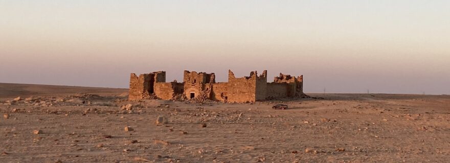
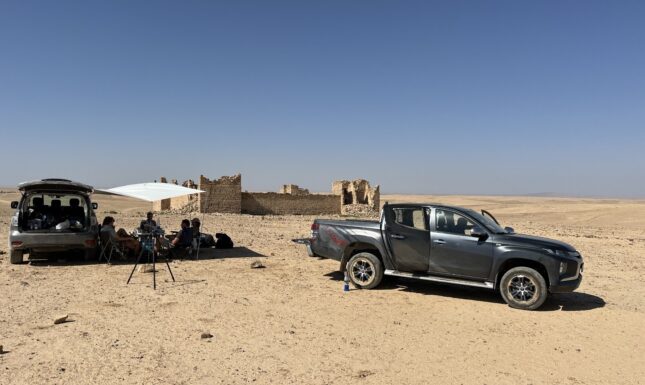
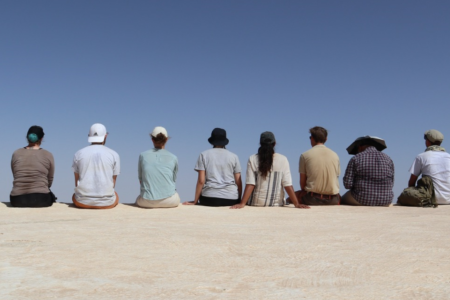
At first, the Roman frontier fort of Qasr Bshir was hidden from view, but as we crested a hill on the third day, its imposing silhouette emerged. Built upon a small rise within the wadi, the fortress carried the marks of time, with its stone walls and towers eroded by centuries of wind and sand; remarkably, all still standing, and still multiple stories high. As we got closer, we got off the road and onto the desert pavement, with a dust cloud forming behind us we drove towards the fortress avoiding the big rocks that lay around us. The surroundings were barren, with only a few bushes and a dried-up stream that used to meander to the old water basin to our left. The fort stands as a shadow of its past, yet still held a powerful stance in the surrounding region. After having parked the 4x4 in front of the fort, we were welcomed by Dr. Fawzi Abudanah and one of his students. We began our initial exploration inside the fort, where rubble from the inner walls and buildings were now accumulated onto massive stone piles, fanning out to the desert pavement, leaving but a small, exposed area in the center.
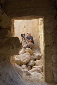

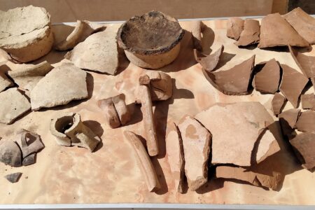
It was in the following days that we first began by collecting the large amounts of trash which had gathered in and around the fort (around 15 bags of garbage, 6 gallons each). We then went on to collect the various forms of data we wished to gather for the project. We immediately began the process of 3D-scanning the entire fortress to conserve the best-preserved Roman fort in the world. We meticulously mapped every detail of the fort, from the door hinges to the cisterns in and around the site. By employing several data collecting tools such as a drone, the 3D far scanner, and several smaller scans conducted with our own phones.
This was all done to create a complete and detailed digital record which ensures that future generations could not only study but also virtually explore this Roman frontier fortress. Our research at Qasr Bshir eventually went on for 9 days, in which we spend one night under the stars near the castle, scanned not only the fortress but also the surrounding landscape, an important Roman water reservoir which lied a few hundred meters to the south, and cleaned the surrounding area of the various accumulations of desert trash.
Udhruh a Roman Castra
Once we had collected the necessary data at Qasr–Bshir we travelled to Udhruh, a Roman Castra (legionary fort) which lies 12 km east of Petra, in southern Jordan. The Castra lies further up the wadi in the highlands at a strategic crossroads. The site lies in a region which saw many different large-scale investments in water management and agricultural intensification, which sparked Leiden University to establish the Udhruh Archaeological Project (UAP) in 2011, in cooperation with Al-Hussein Bin Talal University. The work we would now do would be a continuation of this project’s aims, focusing this year on the 3D scanning of the ruined Castra with the help of a Faro 3D scanner, giving us the opportunity to map out the layout and structure of the legionary fortress with increased precision.
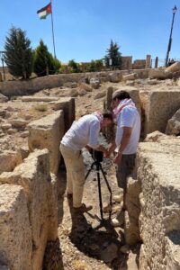
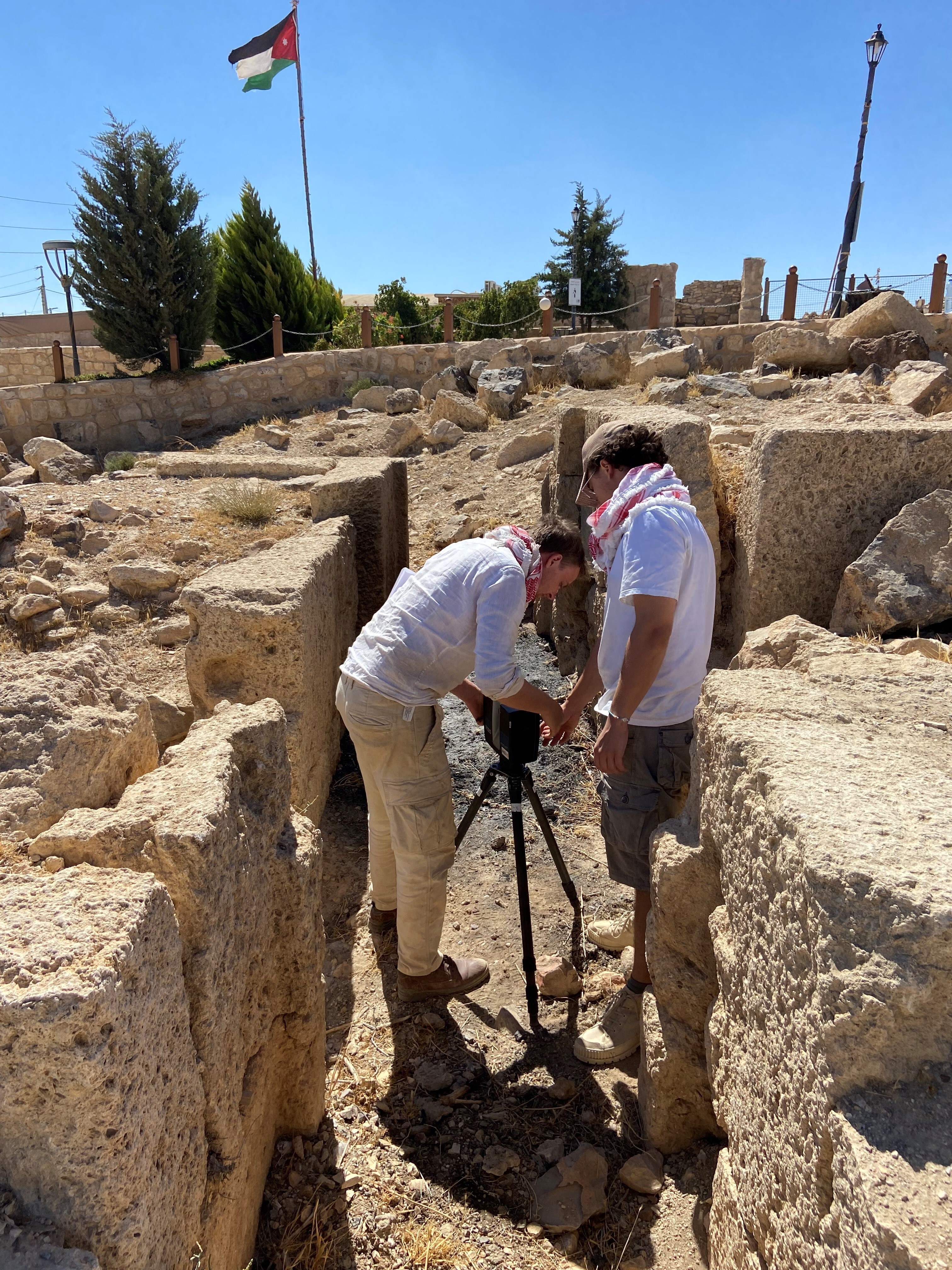
We began by scanning the wall facing north. This wall saw very little-known contemporary modification, whilst having a good portion of the wall exposed above ground. With these scans, it would become easier to gleam the structure of the walls, paving the way to reveal the framework of how these Castra were originally built in the region. Getting a clear 3D model of the wall and the adjoined towers was easier said than done however, as there were plenty of height differentiation and obstructions to the line of sight of the Faro 3D-scanner. However, with some careful strategic placement and a lot of waiting under the Jordanian sun, a complete picture of the Northern wall and North-Western Tower was made. In the following days this process was repeated for the remaining walls and towers.
In addition to the occasional herder crossing the site with a large flock of hungry goats, we saw many local children, on their way back from school, interested in the strange spinning 3D scanning device. It soon became challenging to communicate with them that we had to hide behind the larger blocks together to stay out of sight of the active scanner. Using a translator application, we tried to answer their curiosity before they had to go back home for lunch.
The Qanat
Yet, the Castra were not the only reason we came to the area. Another important aim of the project was the investigation into an ancient irrigation system located a few hundred meters south of the Castra: the millennia old qanats. These qanats were ancient underground canals systems, dug out to transport ground water tapped from an aquifer or a high-altitude water source near the beginning of these galleries, capable of transporting the water over kilometres by means of a very slight incline. The qanats are very important remains of an ancient water management system, leading water into large reservoirs used to irrigate fields in this harsh climate.
These qanats were made by digging vertical shafts with roughly 30 to 35 meters between them. When the appropriate depth was reached, they then dug towards each other to connect the shafts. Interestingly, this leaves many traces of human activity, and human error, as we observed that some of the shafts did not connect properly and had to be dug slightly higher to reach the other galleries! One of these qanat shafts was identified and opened a year prior, which also saw the addition of a concrete barrier which provided easier access into the shaft and further stability. To prevent people (or roaming goats) from falling into the shaft and to protect it from potential vandalism, the hole was covered with concrete slabs and sand. This meant that the first step was to once again open it up, with the help of shovels and some fantastic background music. After this step, we set up a three-legged pulley system over the shaft so we could be lowered into and lifted out of the 20-meter-deep narrow shaft.
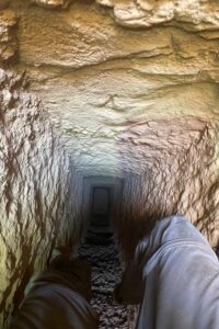
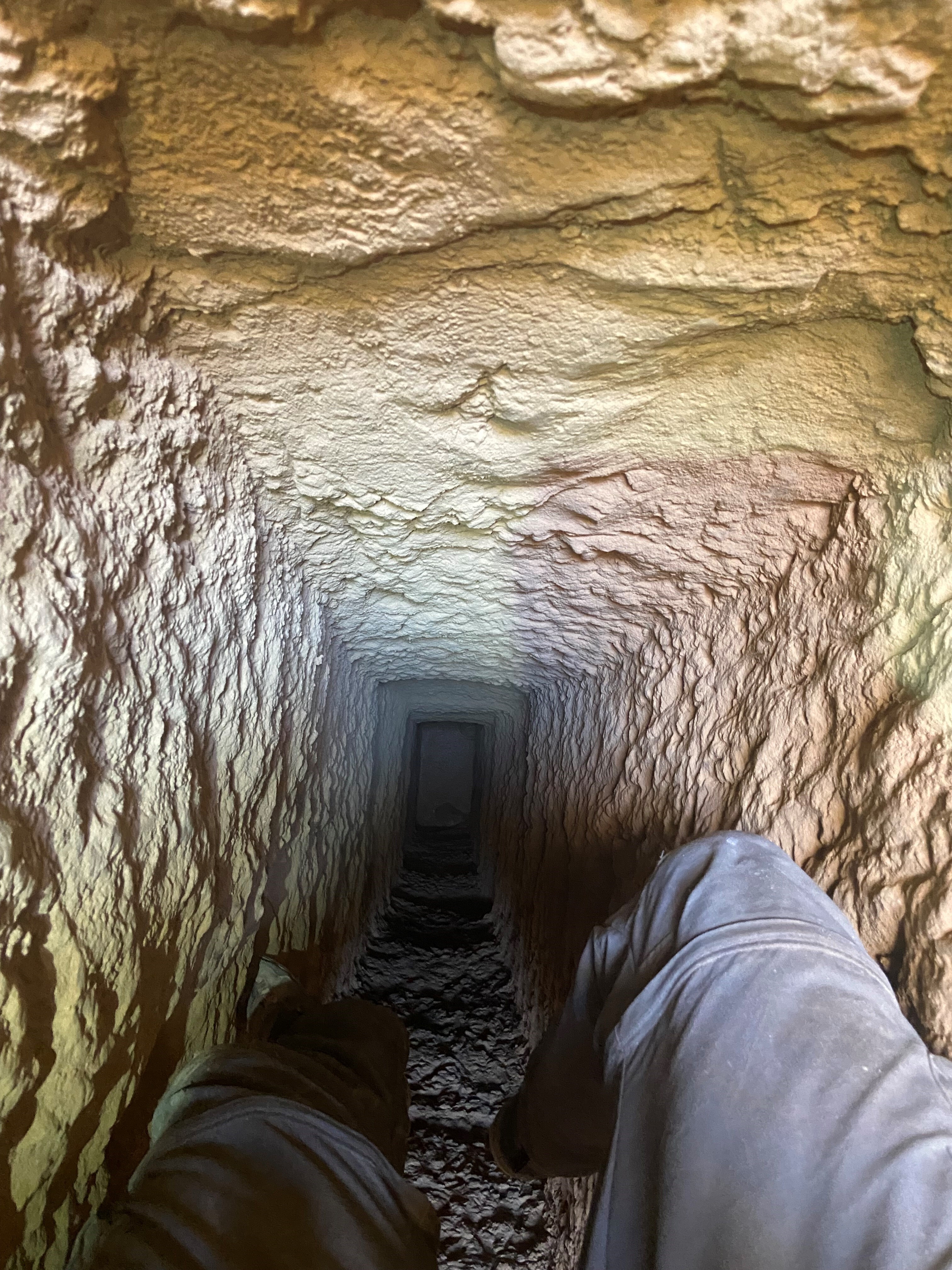
With harness, lamps, shovel, pickaxe and helmet, our very own Dr. Driessen descended first down the narrow, to clear away the debris that had piled up at the bottom of the cavity. as debris prevented access to the rest of the gallery. Having cleared the way, the rest of the team was also capable of going down and exploring the tunnels, yet only the next days, as the qanat did not contain a lot of oxygen Further down the tunnel it made a slight bend, indicating that the former diggers had missed each other only slightly and had to correct themselves. This also led the sealing to be higher around this area, which ended up being around 3 meters high. At last, the Faro scanner was lowered down into the shaft for the 3D scanning of the tunnels, something that had not been done before in this region.
On Sunday the 6th of October we had the honour of receiving a visit from the ambassador of the Netherlands to Jordan. He and a small delegation of journalists visited the qanat to learn more about its history and the potential benefits this research might provide for the area in the future, as the area suffers from drought and hit-and-run farming, damaging the now diminished local aquifers. The ambassador even went down the qanat shaft himself together with Dr. Driessen, where he was shown the inner workings of this ancient marvel.


0 Comments
Add a comment